Table Top Park to Budginigi Hill
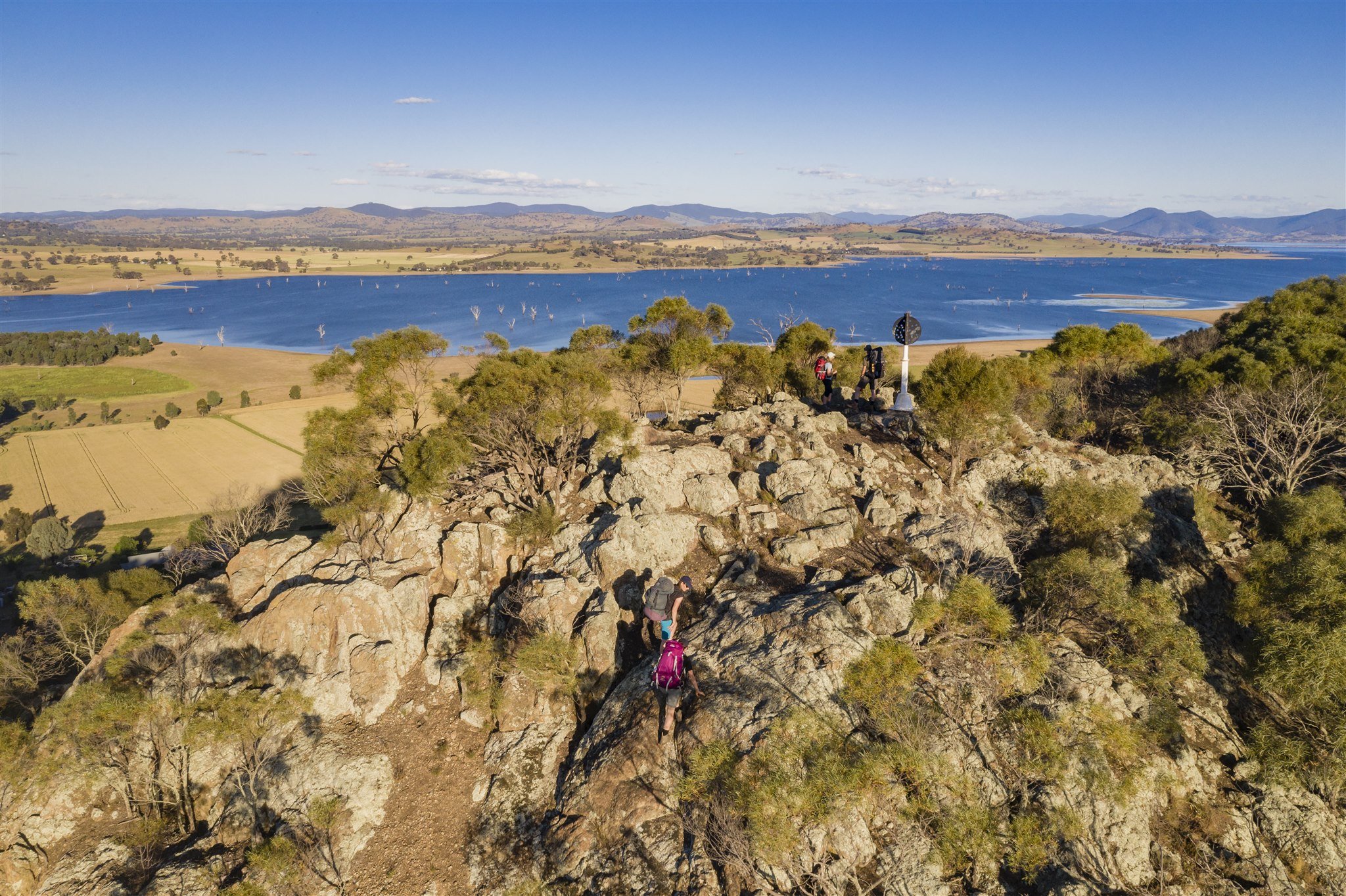
The summit of Big Budginigi Hill provides 360 degree views. You can see for miles looking out over Lake Hume and farming land of the region. Table Top can be seen to the north and Albury to the south-west. It is a significant rock outcrop with a conical shape.
Distance: 3 km one-way
Grade: Medium
Nearest towns:
Albury – 20km to Table Top Park
Dog permitted: Yes
Cyclists permitted: Yes, but not suitable up Big Budginigi Hill.

Above: Budginigi Hill
Walking notes
It is an easy walk along Table Top Road and Mitchell Road to the base of Budginigi Hill where there are picnic tables. A short but fairly steep scramble over rocks will take you up to the lookout on top of Budginigi Hill.
How to access the track
Table Top Rd / Track follows the Old Hume Highway on back roads from Bowna Rd intersection through to Table Top Road and follows this until it meets Riverina Highway which has cycle paths alongside. There is no access on the track across Bowna Creek when the Hume Dam is above approx. 80% capacity due to flooding.
Walk out and back – there is limited roadside parking at Budgingi Hill.
Maps and Downloads
Nearby highlights


Tin Mines Campground to Hovell Tree (Albury)
93.8km / Estimated 33.5hrs / Grade: Easy