

Hamilton Hume was born at Toongabbie, near Parramatta, on 19 January 1797, and was one of the first children born of free parents in NSW.
In 1812, his father received a land grant of 100 acres near Appin and the family moved to the very edge of settlement. This pleased Hume greatly and he set out to explore the bush near his home, going increasingly further a field with his brother, John, and an Aboriginal friend. On one trip they went as far as the Wingecarribee River, discovering good grazing land that was soon taken up by stock owners.
Hume soon had a reputation as a scout, bushman and discoverer of new lands. His services were sought by wealthy, private landowners seeking to extend their holdings and by government office-bearers.
He made exploratory journeys as far as the Goulburn Plains and Lake Bathurst, to the Bungonia and Wollondilly areas and on the south coast to Shoalhaven, Clyde Rivers and Jervis Bay.
For his services during these early explorations, Hume received land grants of 100 and 300 acres near Appin.
Hume had a reputation as the best horseman and bushman in the colony and there is no doubt that he and the Aboriginals shared a mutual respect.
His demeanour, skills and capacities in the bush made him the true and effective leader on the 1824-1825 expedition, yet he could work well under the leadership of another, as evidenced by the extremely difficult expedition to the Darling River in 1828-29 in which he served under Charles Sturt.
After this he gave up exploring and moved with his wife to Yass where he became an extensive and influential landowner. Hume died at Cooma Cottage in 1873 and was buried in Yass Cemetery.
William Hovell was born at Yarmouth, England, on 26 April 1786. He became a good seaman and was captain of a sailing ship by the time he was 22.
His father-in-law was Thomas Arndell, who had been Government Surgeon in the colony of NSW, and this association helped him get government assistance for passage to Sydney. Hovell, his wife and two small children reached Sydney on 9 October 1813, and he received a land grant.
However, before taking up the grant, he and Simeon Lord, an emancipated convict who had become a wealthy and influential trader, established the New Zealand Trading Company, using two sailing ships Trial and Brothers. The venture failed when Maoris seized the ships and they lost all their goods.
He then took up his land grant at Narellan which was soon increased. Like other early settlers he carried out exploration near his holding and in 1823 went as far as the Burragorang Valley.
As a free settler, ex-sea-captain and landowner he was one of the ‘Sterling Establishment’; a member of the highest social circle, a circle not available to ‘Currency Lad’ Hume.
It was inevitable the leaders, so different in background and outlook, would clash. After the expedition Hovell moved to Goulburn where he acquired more land and was appointed Commissioner for Crown Lands. He died in Sydney on 9 November 1875, and was buried in St Saviours Cemetery at Goulburn.
Hume + Hovell Expedition, 1824
It was the call of an unknown continent that drew explorers Captain William Hovell and Hamilton Hume on an intrepid expedition to scout for farmlands between Sydney and the Bass Strait. Departing Hume’s family farm in Yass on October 2, 1824, the explorers and their entourage trekked 1900km to modern-day Geelong and back in a rugged, four-month journey.
Hovell’s journal recounts their crossing of a swollen Murrumbidgee River, and what’s believed to be the first sighting by non-indigenous people of the Australian Alps and the Murray River. Their journey lives on in place names today, most notably the Hume Highway, and many of the campsites along the route are named after convicts in the expedition party.
The Hume + Hovell walking route is one section of their expedition, bookended by two historical markers: Hume’s heritage-listed Cooma Cottage in Yass and the Hovell Tree in Albury, where you can still see the explorer’s name that was carved into its trunk on November 17, 1824.
The leaders had a tent between them, the men were to sleep under a tarpaulin and each man had a blanket. They had navigational instruments (sextant, false horizon, compasses) and a perambulator (wheeled measuring device) to ascertain the distance travelled each day. A small pack of dogs was taken with the intention that they should run down game for the pot.
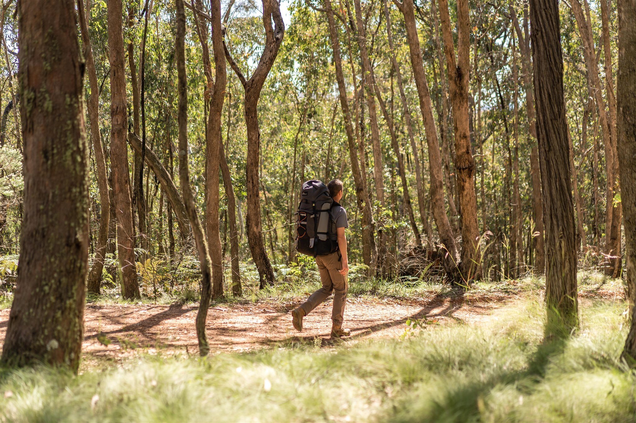
Walking through history
In 1824, Sir Thomas Brisbane was Governor of NSW, a colony with a population of over 30,000, more than half of them convicts or emancipists. Many had served their time and were keen to make a new start. Soldiers were electing to take up promised land grants at the completion of their military service and increasing numbers of free settlers were arriving. For most, a living and the hope of future prosperity lay in the land.
Eager land seekers pushed their flocks and herds to the fringe of known country only to be leapfrogged by the following wave of settlers anxious to get to the next piece of prime land before anyone else.
White man’s huts were on the Bathurst plain, the Illawarra coast, the Monaro and the Goulburn plains and getting further beyond the control of government authority. While the individual settler or squatter was concerned with finding a new run for himself, the government concerns were on a wider scale. Where did the western rivers run to – an inland sea or the southern coast of Australia? What lay between the Goulburn plains, the point of furthest settlement, and Bass Strait? The French had been exploring the southern coast of Australia. Were they considering making a settlement? Governor Brisbane wanted answers to these questions and suggested that a party of convicts be landed on the southern coast between Cape Howe and Wilsons Promontory, with the promise of suitable reward if they found their way back to Sydney.
It was suggested to the governor that a skilled bushman be put in charge of the convicts and Hamilton Hume’s name was put forward. When Hume was approached he showed interest but disapproved of the idea of not starting from an established base, which could be returned to if circumstances required. Hume put forward his own proposal – he was willing to lead a party from Lake George to see if an inland way to Bass Strait could be found.
The Governor approved, however Hume was advised that the government would not bear the cost of an expedition but that he could proceed, at his own expense, under the government’s‘ sanction and protection’.
It was at this point that William Hovell, an ex-sea captain who was now on the land at ‘Narelling’, near Minto, got wind of the plan and wished to be involved. Hume and Hovell met and decided to jointly fund the expedition. Each provided three convict servants (Hume’s James Fitzpatrick, Henry Angel and Claude Bossawa, and Hovell’s Thomas Boyd, Ben Smith and Samuel Bollard), a cart and harness each and between them five bullocks and three horses.
Hovell recorded he supplied four months provisions for himself and his three men; namely 640lb flour, 200lb salt pork, 100lb sugar, 14lb tea, 8lb tobacco, 12lb salt soap, coffee, etc. and Hume did likewise.
The Governor did sanction the allocation of fifty pounds worth of goods, in the way of pack saddles for the bullocks, a firearm and limited ammunition for each man and a ‘set of slops’ (clothes) for each man. But there was a proviso that everything had to be returned after the expedition.
The leaders had a tent between them, the men were to sleep under a tarpaulin and each man had a blanket. They had navigational instruments (sextant, false horizon, compasses) and a perambulator (wheeled measuring device) to ascertain the distance travelled each day. A small pack of dogs was taken with the intention that they should run down game for the pot.
Each leader had personal belongings, writing materials and they had a medicine kit to cover both human and veterinary injuries and illnesses. Both Hume and Hovell were provided with a map showing the coast line of south-east Australia but otherwise blank, with instructions from the Governor that they were to put in daily details as they progressed.
The expedition left Hume’s father’s property at Appin on 3 October 1824 and by 13 October had reached Hume’s outstation on Lerida Creek (Fish River) near today’s town of Gunning. Hume had already been a little further west, as far as Yarrh (Yass) but what was beyond that was unknown.
The journey was fraught with troubles through rough terrain stricken by drought, flood and bushfires. However, after 11 weeks the party reached the coast on 16 December, 1824. Both leaders mistakenly believed they had reached Western Port when, in effect, they had reached Corio Bay on Port Phillip.
There was no time for rest and further exploration and on 18 December the return journey was started. Hume’s leadership and bushmanship came to the fore as he had promised the men he’d get them back in a month, this on a starvation rations with worn out clothing and equipment the hunting dogs lost and pack animals almost exhausted.
Hume was able to shorten the return journey by 150 miles (240km) and keep away from the most difficult terrain. On 18 January, 1825, they reached Wee Jasper. The bullocks had to be helped to make the stream crossing then struggle up the bank where they were abandoned to fend for themselves. Two men were in such poor condition they had to be carried in the carts pulled by the horses.
When Hume’s outstation was reached the party broke up and on reaching Sydney each leader did his own reporting. Everyone was grateful to get back alive but, even for the leaders, it must have been an anticlimax.
'Eager land seekers pushed their flocks and herds to the fringe of known country only to be leapfrogged by the following wave of settlers anxious to get to the next piece of prime land before anyone else.
-
(The quotations shown in italics, with errors included, are taken directly from Hovell’s Journal.) Hume had an outstation, ‘Wooloobidallah’ on Lerida Creek near today’s town of Gunning, after being one of the first white people to visit the locality in 1821. It was from there, on Sunday, 17 October 1824, the expedition commenced and moved into an area known as Yarrh (Yass), the furthermost point of white settlement in NSW. On 19 October the party reached the Murrumbidgee River and were alarmed to find a deep, fast flowing stream in flood. The flooding did not abate so on 22 October a tarpaulin was wrapped around the body of one of the carts to convert it into a makeshift punt. Hume and the convict Boyd swam the river with a rope and the punt was pulled back and forth transporting the equipment, provisions and non-swimmers. Hovell’s journal says “..in about 8 or 9 turns we had every thing across, the cart we laid fore and Aft the boat, with the shafts aft, & the wheels off and by 3 P.M, the 3 horses & 5 Bullocks were swum over and by 5 oClock, everything was stowed away, thus we did accomplish what we before thought impracticable”. During the next couple of days the team had difficulty finding a way through the very rough country. The leaders, each taking some convicts, eventually separated, seeking a passable route for the carts. While searching for the carcass of an emu that had been killed, Hovell, with Boyd, found themselves isolated for the night where he recorded “..we had the satisfaction of sleeping in the bush for our pains, besides going to bed Supperless”. Shots fired by Hume the next morning brought the expedition members back together. On 25 October, they found the valley of Sugarloaf Creek gave them access to another large valley, referred to as Lime Stone Valley by Hovell, and a stream. This was Goodradigbee River, a tributary of the Murrumbidgee River. The extremely rugged country and the mountainous ranges beyond the river convinced the leaders that the carts could not be taken any further. Consequently, the necessary supplies were loaded into packs to be borne by the bullocks and the remaining supplies and the carts were concealed “..out of sight from Natives, but in this case I have little hopes of, as very few things which they pass can escape their penetrating Eye”. It was thought that the new river would join the Murrumbidgee River within a few miles, as Hume had information from Aborigines that the Murrumbidgee River was a passage that would take them far beyond the mountainous country. However, as they moved down the stream they found themselves confined to a narrow gorge where Hovell recorded “..it is quite clear that we could not pass with our loaded cattle this way the foot path being between a highe perpendicular Mountain, and the steep banks of the river, only wide enough for one person to pass, Mr Hume with great difficulty got to the Top of the Mountain, over which we were standing”. From his vantage point, Hume could see that the river still ran through very rugged country for some distance, so the party went back up the Lime Stone Valley and looked for a way to climb out. The turn back point between the peaks of Barren Jack and Black Andrew later became the site of Burrinjuck Dam. They repassed the hidden carts and continued to the end of the open valley floor (Wee Jasper area) where camp for 28 October was set up.In an exploratory outing, Hume had noticed a side valley a little further up the main valley, which gave him hope. The following day a start was made up this valley only to find it became “..a mountain chasm of not more than ten feet wide. The precipitous sides of this were upwards of a hundred feet in height, and the bottom of it forms the bed of a small stream, at present about two or three feet deep. Their route up this, is of course impracticable.” - Bland. This description fits the gorge a few hundred metres up Micalong Creek. The party came back down Lime Stone Valley but the leaders determined a climb out of the valley had to be attempted. “ .. the only alternative we had now left was to face the first Mountain that we thought easiest to ascend and after 2 or 3 hours fatague (more to the beasts, then ourselves, who had not less , each then 200 &250lbs) we by going zig.zag along the side, got to the top of the highest Mountain near us, without any accident”.
-
After the strenuous climb out of the Lime Stone Valley the party continued for another mile and a half (2.4km) before they found water, likely in Racecourse Creek about 2km east of the summit of Mt Wee Jasper. The huge trees growing in this area impressed Hovell but the fallen timber, dense scrub, rough ground and wombat burrows made travel slow and exhausting for both man and beast. “We had to unload twice to day once to cross a very rockey bottom Creak ... and the second time to cross a Swampey valley.” This was likely Micalong Creek and then Micalong Swamp. On Sunday, 31 October, they made their way along the Micalong Swamp seeking a crossing spot. Hovell recorded that areas of the swamp had been burnt by the ‘Natives’ with the expectation that new growth would encourage game to move in. He also spoke of emus seen across the swamp. This location is significant as, on the return journey to bolster the men’s flagging spirits, Hume promised he would lead them back to the place where the emus were seen near the swamp. Subsequently, he did. - Notes by Harry Hill
-
On the afternoon of 2 November, from a vantage point on a hilltop the explorers looked down into a wide valley containing a large river. No name was recorded at the time, but later Hovell referred to it as the Medway River “..we afterwards learned was called by the Natives Tumot”. In subsequent written accounts, ‘Doomot’, ‘Toomot’ and ‘Tumet’ were also given as spellings and the river, and town, finally became ‘Tumut’. Camp was established before the river was reached and early on the morning of Wednesday, 3 November, after travelling 3 miles (4.8km) “..brought us to the banks of the river, which was running very strong, equel to any of the others we have passed, and about 80 feet wide, & 3 or 4 feet deep - with falls”. Although they wished to cross the river, its depth and strength of the current prevented them and they were forced to continue upstream, on the eastern bank, for another 4.5 miles (7.2km) only to find the river turned to the east and into mountainous terrain. They came back downstream for 1.25 miles (2km) and found a spot where Aborigines had been fording the river, approximately 700m upstream from where Bowlers Creek joined the Tumut River. The river was described as being “..150 feet wide, the stream very Strong, Stoney bottom, and about 2 feet deep, the falls being a little below us”. Crossing was made without incident and camp set up. Rather surprisingly, on 4 November they made their way back up the river but on the western bank. They crossed a low gap in the hills only to find they looked back down on the stretch of river they had shunned the day before. The only course was to immediately turn west, climb a steep ridge (Gurkeroo Ridge) and hope it took them to a tableland. A slow and fatiguing climb saw them cover only 2 miles (3.2km) in an hour and a half, and they were forced to spend the night on a “..causeway, not more than 20 feet wide, and about 200 feet long” – Bland. Heat, insects, shortage of water, bellowing bullocks and calls from hidden Aborigines helped to make it an unpleasant night. “At Sun rise we started to ascend the Second Mountain in the cool of the Morning, and after getting within a distance of about one furlong from the top, we found it necessary to unload the beasts and to take them to the Top empty, and for the Men to bring up their loads”. Thus, they reached the tableland in today’s Bago State Forest, less than a kilometre North-East of Buddong Falls. They could now adopt the desired course “...on the highest part of the range (The Hume Sketch later named it Mount Columbus) .. the Soil is of Coarse Granet: and good, the Timber, which is Black butted Gums, Stringey bark, & other all of an Excellent quality”. By midday they reached the tableland’s end and looked down into a valley, with what they assumed was a large river, and beyond “..saw a very high mountainous Country ahead of us ... there appeared to be a brake in the Mountains South from us, I could perceive Mountains, in my opinion much higher than any we had yet seen”. The descent, probably down Pound Ridge, was not without incident. “Mr Hume’s Bullock & driver, together with every thing upon him, occasioned by one of the Stones giving way from under him, and had not a Tree brought them up they must to a certainty have been dashed to pieces, by the fall into the creak below”. They reached the bottom to find the river was only a small creek and established camp near the junction of East and West Burra creeks. The Sunday was made a day of rest and reflection. Clothes were washed, fresh kangaroo meat enjoyed, the bullocks’ backs rubbed by the pack saddles were treated and animals ate their fill. Hovell recorded “We are again tormented by our New {but constant} companions, the Small Fly & the Misquetres, there is no getting rid of them, as they will stand Fire, & Smoke, as well as ourselves, my legs at this Moment (a little above the Socks, are one Complete sore to within a few Inches of the Knees”.
-
The relaxation of the Sunday carried over to the next day as the party had breakfast before leaving to continue down the creek. After 5.25 miles (8km) the creek increased in size and Hovell recorded “..it had now formed it self in a large Stream it had three falls, each about 10 or 15 feet, & at ragular distances”. This part of Burra Creek is below today’s Henry Angel Trackhead. A little further on, the creek valley started to deepen and the ground became very rough. A stop was made while the leaders climbed a hill to see what lay ahead. From the flank of the hill they obtained an awe-inspiring, but alarming, view of the western face of the main range (Snowy Mountains) with the top quarter covered by snow. At this point the leaders had a difference of opinion as to the direction they should head. Hovell favoured heading towards the snow covered mountains (then named ‘South Australian Alps’), while Hume thought they should turn west to get well away from the mountains before turning south. For a time each leader, with his own convicts, went his own way, but by nightfall Hovell had changed his mind, doubled back and had caught up to Hume. The party had travelled 15 miles (24km) and camp was set up on Tumbarumba Creek. Hovell noted that they were 350 miles (560km) from Sydney. The following day was one of the most pleasant ones the explorers had experienced. They were able to set a course, and hold it, as they travelled across gently undulating country. Grass, for the animals, and water were plentiful. There was little in the way of trees so viewing was unimpeded. At 4pm, after travelling 12 miles (19km), they again saw the snow capped mountains to the south. Soon after, camp for the night was established (likely on Horse Creek near today’s ‘Rippling Water’). Two kangaroos had been killed during the day, but the larger of the two had almost caused the loss of one of the hunting dogs, it “..being cut from the throat round the inside of the shoulder...”. On Wednesday, 10 November, they started early to cover ground before it became too hot. (Hovell recorded that the noon temperature was 98 degrees F.) It was hoped that the previous day’s course could be maintained but it, unexpectedly, took them to a deep ravine, recorded as being as much as 1,000 feet deep. They turned back and a kangaroo pad took them down Sandy Waterhole Creek and on to Coppabella Creek. They followed Coppabella Creek to the north, although this was not the direction they were hoping to keep, and established camp where the valley became enclosed. The next day they turned west to climb a large hill. The climb was slow and strenuous and it took three hours to cover the three miles (4.8km) to the summit. They had hoped they would have reached a tableland that gave them passage to the southwest, but found they were on an isolated spine and there was no alternative but immediately to descend the opposite slope. They reached Lankeys Creek where they ate breakfast and, because of heat and exertion, rested for 4 hours.
-
Hovell wrote “..to describe the way in which we were tormented by the small Fly, and the Misquetos, is almost impossible Suffice it to say, to Write, to read, to Sleep, or to rest in any place we got too, was impossible, our whole time was employed in Grumbling, Scratching or beating them away with our handcorchifs The Dogs get into the water, the Horses stand in the smoke of the fire, and the Bullocks get onto the shadiest place they can find, or lay down among the reeds or long grass, I know of no other plan to adopt, unless it is to be like the Natives themselves go naked and lay in the dirt and smoak”. Thanks to the hill they climbed, the party had obtained more views of the snow-capped ‘South Australian Alps’ to the south and south-east. This sighting was enough to cause Hovell to state that, from his knowledge of the NSW coastline and now the evidence of this mountain chain, the mountains stretched to Wilsons Promontory and were sufficient to “..prevent all Communications between Western Port and the Eastern Coast, unless a Gap could be found through them”. The journey recommenced at 3pm. The journal account for the rest of the day is sparse and conflicting. However, Dr Bland, a friend and contemporary of Hovell, published an account of the expedition using the journal and other information supplied by Hovell, so the route for the afternoon can be determined.