5 / Towards the mighty Murray
Tin Mines Campground to Hovell Tree, Albury
Nearest Towns: Albury
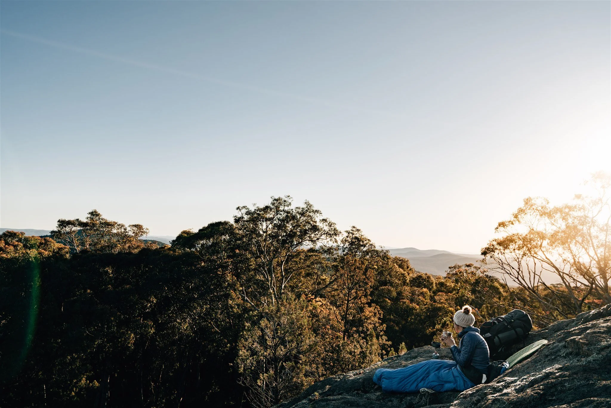
Wake up with an early brewed coffee and get ready to continue through the beautiful Woomargama National Park. From Tin Mines you will have the opportunity to stop at Norths Lookout overlooking the folds of the Great Dividing Range.
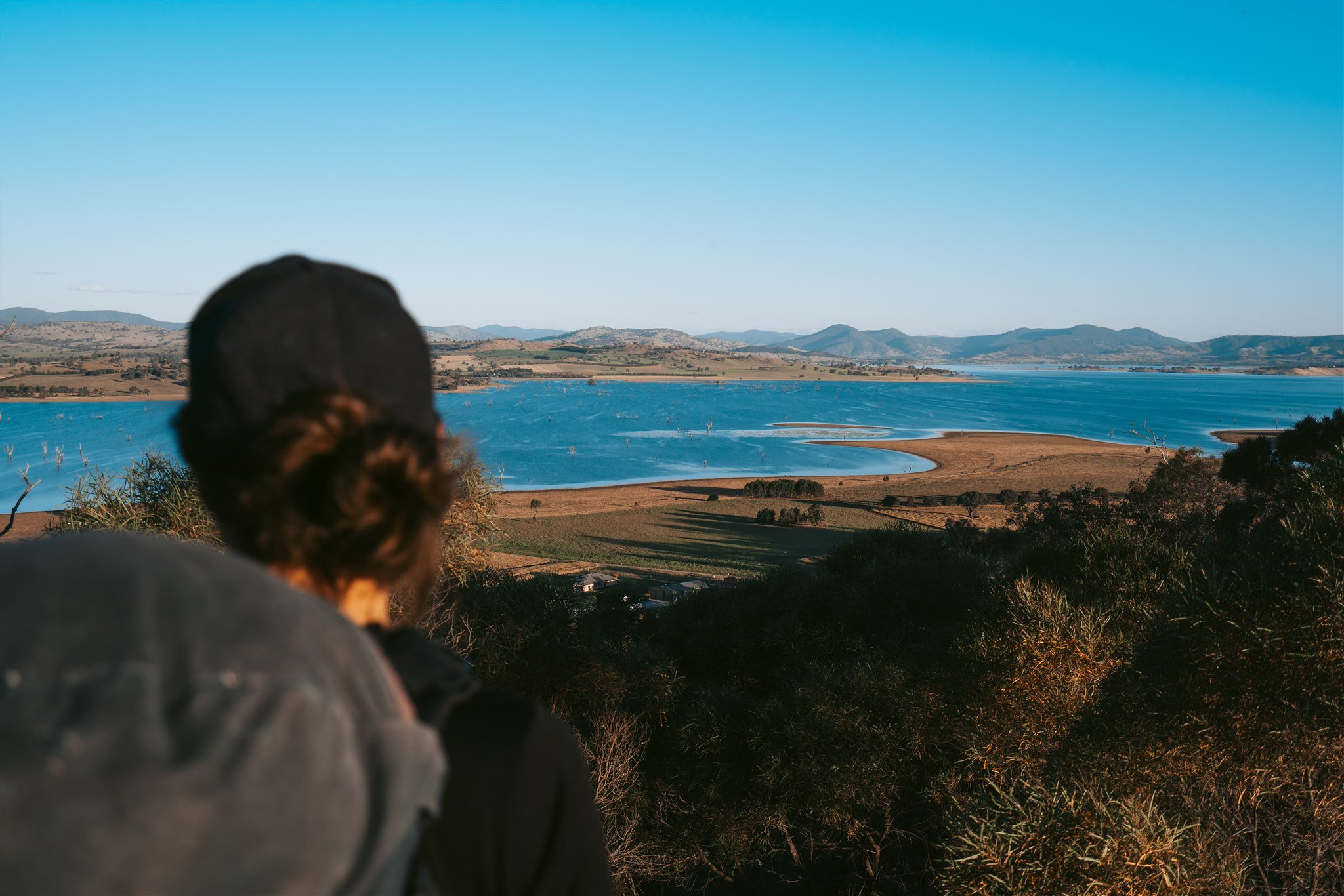
On route you’ll be rewarded with spectacular views of the Australian Alps and the Hume Weir.
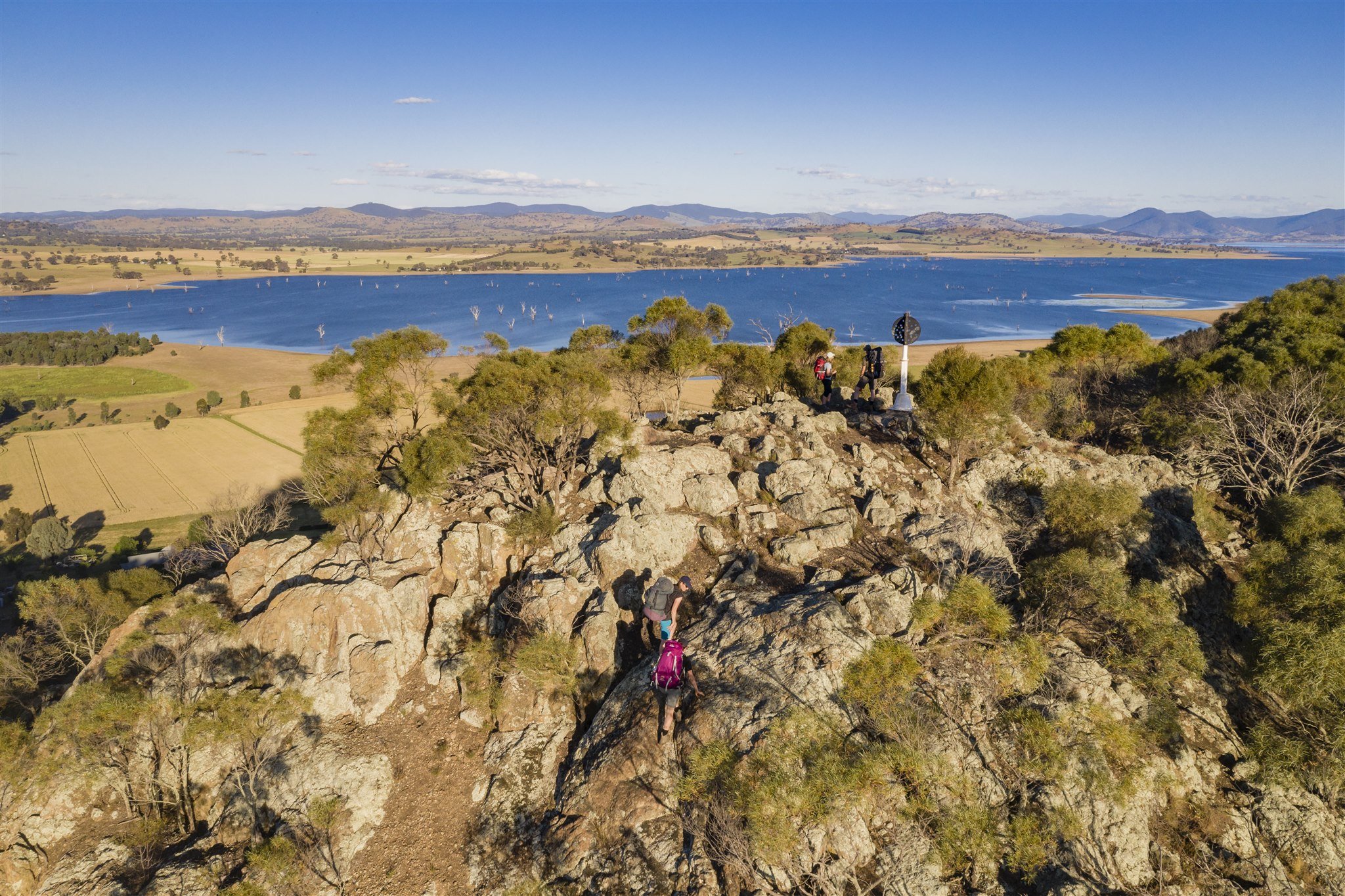
Closer to Albury, it’s a short, sharp climb up nearby Budginigi Hill which overlooks Lake Hume – just a stone's throw from the end of your epic journey.
The Hovell Tree at Albury marks the end of the Track. Inscribed by the explorer, it’s located in what’s now a city park on the banks of the Murray River. Before you reach the tree, you’ll cross through farmland boasting sweeping views of Table Top Mountain and Hume Weir.

Section 5 / Highlights


Maps and downloads
Map 5 - Tin Mines Campsite to Hovell Tree
Estimated walk times
SECTION 5 / Tin Mines Campground to Hovell Tree, Albury: 93.8 km / 33 hrs
Tin Mines Campground to Samuel Bollard Campground: 19.8 km / 7 hrs / Grade: Medium
Samuel Bollard Campground to Tunnel Road: 1.5 km / 30 mins / Grade: Easy
Tunnel Road to Lake Hume Holiday Park: 23.7 km / 8 hrs / Grade: Hard
Lake Hume Holiday Park - Lake Hume to Table Top Park: 21.9 km / 7.5 hrs / Grade: Easy
Table Top Park to Hovell Tree: 26.9 km / 10 hrs / Grade: Easy
How to access the track
Woomargama National Park tunnel road entrance / From Woomargama, take Berry Street, which becomes Tunnel Road. Follow for 11kms until the Hume and Hovell Track crosses Tunnel Road at Hanel's Road. Opposite side of the road is Tin Mines Fire Trail Rd
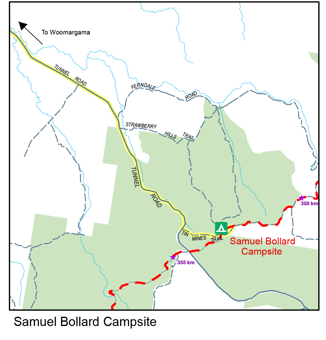
Samuel Bollard Campground / Sits on Tin Mines Fire Trail Rd (Tin Mines Rd turns into Fire Trail road after Tin Mines Campground) access from Tin Mines Campground or from the south is accessed off Tunnel Road, meeting with Tin Mines Fire Trail Rd
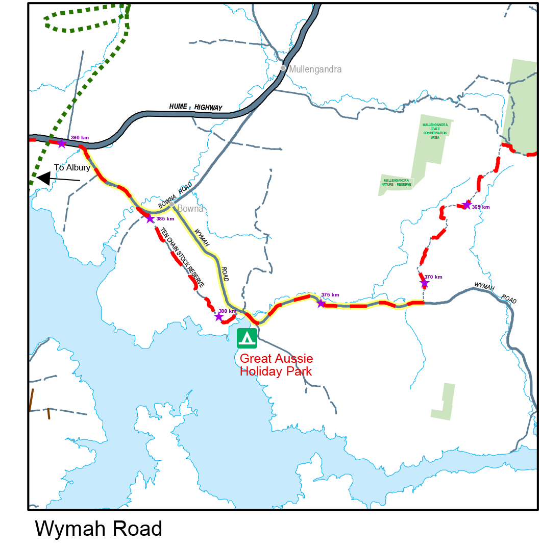
Wymah Rd / Track meets Wymah Rd - Hume Highway, to Bowna Rd to Wymah Rd
Table Top Rd / Track follows the Old Hume Highway on back roads from Bowna Rd intersection through to Table Top Road and follows this until it meets Riverina Highway which has cycle paths alongside. There is no access on the track across Bowna Creek when the Hume Dam is above approx. 80% capacity due to flooding.
Hume Street / Hovell Tree is at Hovell Tree Park, access from Hume Street.
Nearby campsites


Walking notes

Above: Budginigi Hill
From Tin Mines Campground, the walking track continues to use Tin Mines Road running east-west through Woomargama National Park. Track junctions carry Hume & Hovell Walking Track signs and logos. There’s a long, steady climb over 8km from Tin Mines Campsite to the top of Mount Jergyle allowing for glimpses of Mount Narra Narra and Mount McLaurin on the right from North's Lookout. Sightings of Mount Nerra Nerra (Friday Mount) were seen by the explorers on Friday 12th November 1824. From Mount Jergyle the track runs almost west along a ridge for 3km until it drops into the valley of Home Flat Creek from where there may be glimpses of the water in Hume Reservoir to the south.
About 20km from the Tin Mines Campsite you will reach Samuel Bollard Campsite. From here, a foot track meets Tunnel Road after about 1.6km and continues on a fire trail on the southern side of Tunnel Road for about 300 metres. At a sharp left hand turn on the dirt road, the track continues straight ahead (west) onto a foot track which continues into the Woomargama State Conservation Area. The track comprises about 4.5km of single track through to another fire trail which skirts the southern boundary of the Conservation Area before emerging from the forest into private property, approximately 8km from Wymah Road.

Above: North’s Lookout, Woomargama National Park
Part of the track here is near the timberline, running along farm fence lines, but much of it is out in open, undulating country.
The walking track comes out onto Wymah Road which is followed west for about 7km. Just before Fowlers Swamp Creek, the entrance to the Lake Hume Holiday Park is located on the left. This is a privately owned holiday resort with a variety of accommodation available.
Three hundred metres beyond the bridge over Fowlers Swamp Creek, access Ten Chain Stock Reserve which runs parallel to Wymah Rd for almost 6km before joining Bowna Rd - the Old Hume Highway.
The next section of track, about 4km, follows the old Hume Highway, then a service road (Clancy Rd) parallel to the highway for 3.8km. At the Burma Road junction the track heads down Burma Rd, generally heading south for another 8km and generally uses back roads between the Hume Highway and Hume Reservoir as it moves towards the Albury suburbs of Thurgoona and St Johns Hill. Camping, for track walkers only, is permitted at Table Top Park. Look out for the Ettamogah Pub about halfway through this section, 1km to the west of the track.
Generally the walking track between Budginigi Hill and the Hovell Tree uses road reserves and other local trails established by Parklands Albury Wodonga. The track does twist and turn to some degree and signposting indicates the route to be followed.
The walking track comes out onto the Riverina Highway which is followed for 3km along a new cycle path until a road on the left leads to the Mungabareena Reserve on the northern bank of the Murray River. The expedition moved upstream, along this bank, looking for a crossing spot on 18 November 1824. You are not permitted to camp on the Mungabareena reserve.
A foot track leaves the reserve to climb to the top of Eastern Hill and then drops down to cross the Hume Highway. Eastern Hill provides an excellent vantage point for the whole region.
Walsh, Schubach, Amatex and Hume Streets, in Albury, are used to cover the final few kilometres to the Hovell Tree via South Albury and Noreuil Park and the southern end of the Hume & Hovell Walking Track.