2 / At the water’s edge
Fitzpatrick Trackhead (Wee Jasper) to Blowering Campsite
Nearest town: Tumut
Heading along the track after leaving Fitzpatrick Trackhead you will encounter the climb up Mt. Wee Jasper traversing through the Wee Jasper State Forest.
After camping a night at Log Bridge Creek campsite you will follow single track where you will find the impressive Pompey Pillar - a feature that cannot be missed!
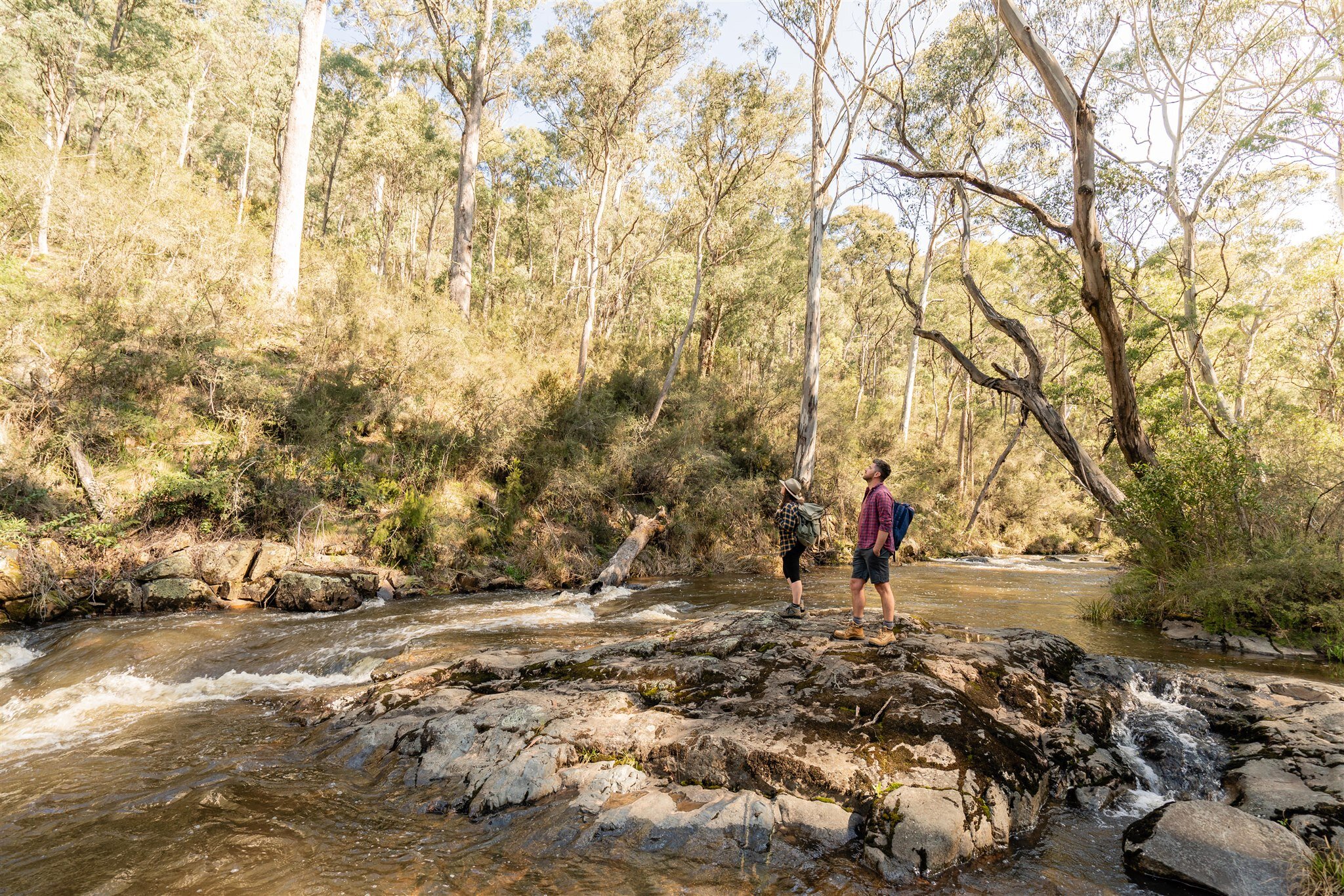
The Track follows the stunning Micalong Creek for a large portion of this section and crosses Micalong Swamp by boardwalk.
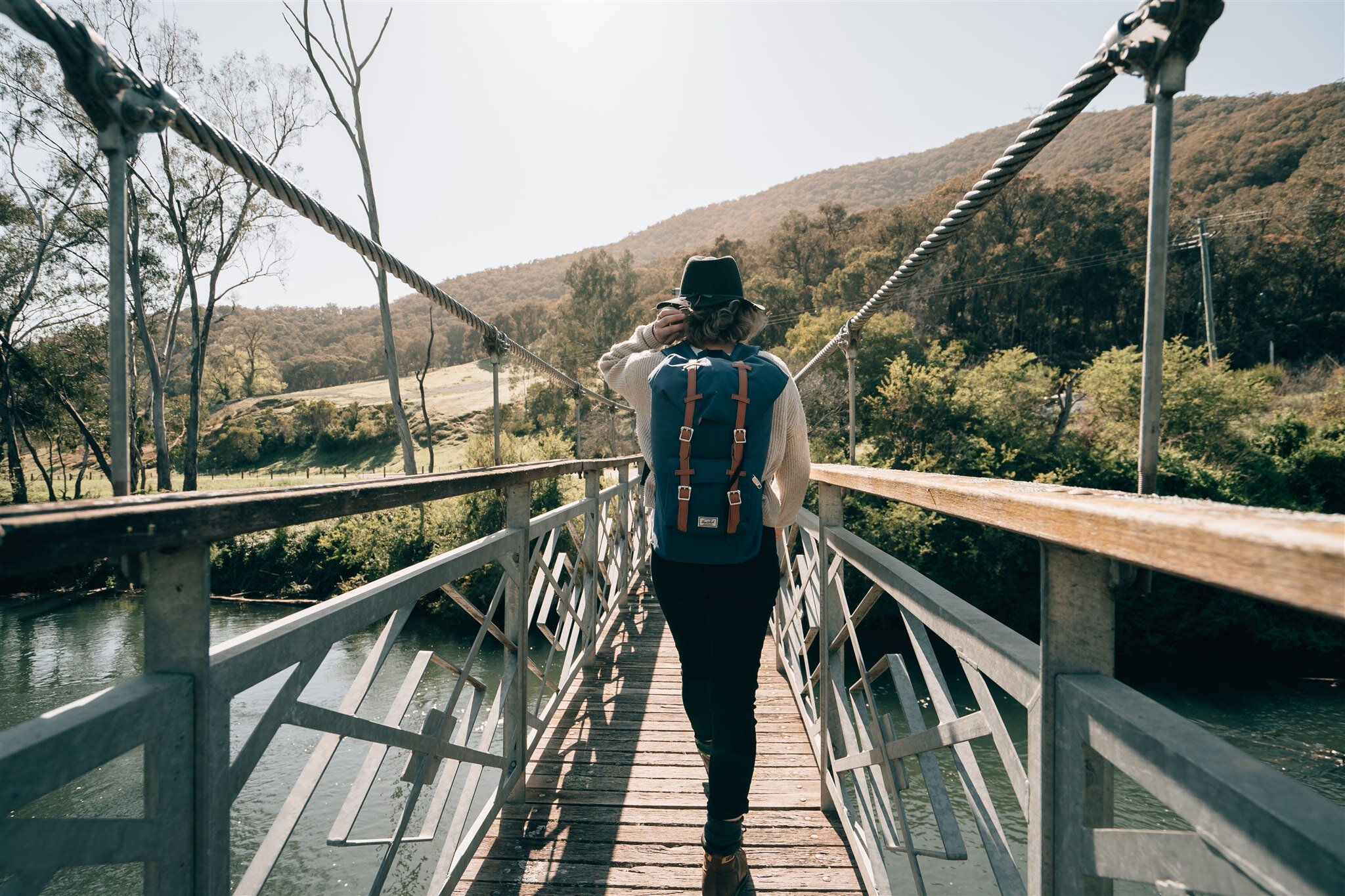
You will enter Kosciuszko National Park and visit ‘The Hole’ a popular place to visit on the track. Further south walkers will cross the Goobarragandra and Tumut Rivers several times by suspension bridge.
Ending at Blowering campsite, you will cross some grazing land and the Snowy Mountains Highway which can take you directly in to Tumut township.

Section 2 / Highlights


Estimated walk times
SECTION 2 / Fitzpatrick Trackhead (Wee Jasper) to Blowering Campsite: 82.0 km / 39 hrs
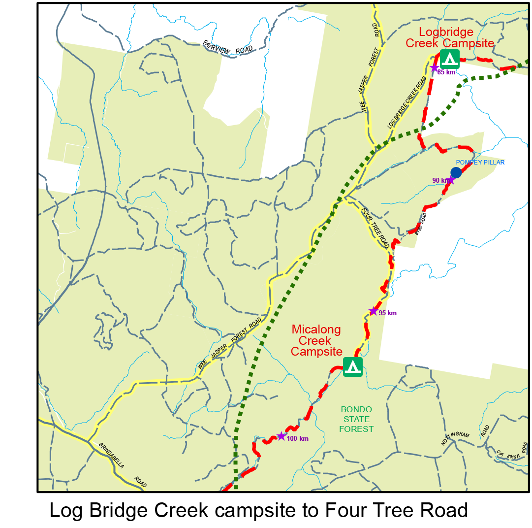
Fitzpatrick Trackhead (Wee Jasper) to Log Bridge Creek Campsite: 12.1 km / 6 hrs / Grade: Hard
Log Bridge Creek Campsite to Micalong Creek Campsite: 12.6 km / 5 hrs / Grade: Hard
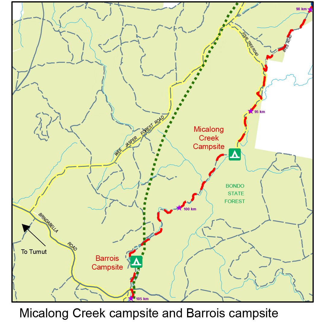
Micalong Creek Campsite to Barrois Campsite: 6.7 km / 3.5 hrs / Grade: Medium
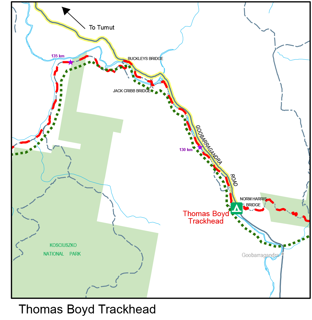
Barrois Campsite to Thomas Boyd Trackhead: 24.7 km / 9.5 hrs / Grade: Hard
Thomas Boyd Trackhead to Snowy Mountains Highway: 18.8 km / 8 hrs / Grade: Hard
Snowy Mountains Highway to Blowering Campsite: 7.1 km / 2.5 hrs / Grade: Easy
Maps and downloads
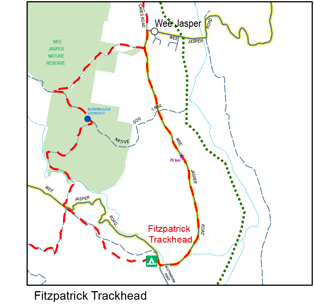
Map 2 - Fitzpatrick Trackhead to Blowering Reservoir
How to access the track
Fitzpatrick Trackhead / is accessed via the Wee Jasper Road from Tumut or Wee Jasper.
Log Bridge Creek Road / accesses the Track just south of Log Bridge Creek campsite. Turn right off Wee Jasper Forest Road onto Log Bridge Creek Road, and follow it until the end and it will intersect the Hume and Hovell Track. Note: please note you will need to walk out from the campground to meet Log Bridge Creek Road for pick up.
Four Trees Road / provides good all weather access to the track off Wee Jasper Forest Road. Turn right onto Four Trees Road off Wee Jasper Forest Road and follow down the hill until just before the Micalong Station locked gates where the Hume and Hovell Track crosses Four Trees Road.
Micalong Creek Campsite / campsite is accessed via Four Trees Road off Wee Jasper Forest Road. Turn right off Four Trees Road at the bollard near the bottom of the hill and follow for approximately 3kms.This forest road is 4wd only and not suitable for winter.
Brindabella Road / The Track crosses the Brindabella Road 43kms from Tumut. Take the first left after Argalong Road to access the Track heading north. From there it is a short walk to Barrois campsite via single track. Take the first right after Argalong Road onto Micalong Road to access the Track heading south. From there the Track is on Micalong Road until it reaches Micalong Swamp, which is crossed by a boardwalk. The Track can also be accessed off Argalong Road where it crosses Chinaman’s Creek via a boardwalk.
Thomas Boyd Trackhead / is accessed off Goobragandara Road. From Tumut, head north-east on the Wee Jasper Road for a short distance, then turn right towards Lacmalac. Head east on Lacmalac Road which turns into Goobragandara Road. Thomas Boyd Trackhead is 25kms from Tumut.
https://thomasboydtrackhead.com/hume-and-hovell-bushwalking
Nearby campsites


Walking notes

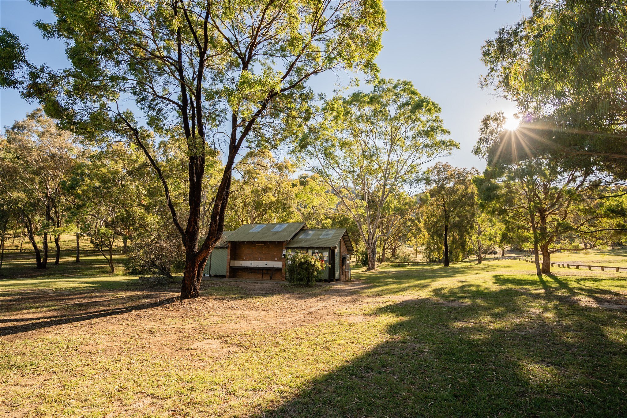
Above: Norm Harris Bridge, Thomas Boyd Trackhead
From the Fitzpatrick Trackhead, the track heads west through fairly rocky terrain before meeting up with Wee Jasper Road, and the junction of the walking track through the Wee Jasper Reserve. The next 6km of the track is all uphill to the summit of Mt Wee Jasper (1,121m). Views from the top of Mt Wee Jasper are restricted, but the climb does offer a rest stop and the chance to sign the visitors’ book, located in a steel container. It’s the first of several such log books placed on the track.
From Mt Wee Jasper, it is 4.8km to Log Bridge Creek Campsite through mostly eucalypt forest and sometimes along the edge of pine plantations. The campsite is a good one to spend the night. If you are not camping here, it’s another 12.6km to Micalong Creek Campsite.
The section between these two campsites follows Millers Creek and back up Pompey Pillar Creek on a single track in fairly challenging terrain. A six metre high natural column of rock (Pompey’s Pillar) halfway up Pompey Pillar Creek is just one of the features of this section of track.

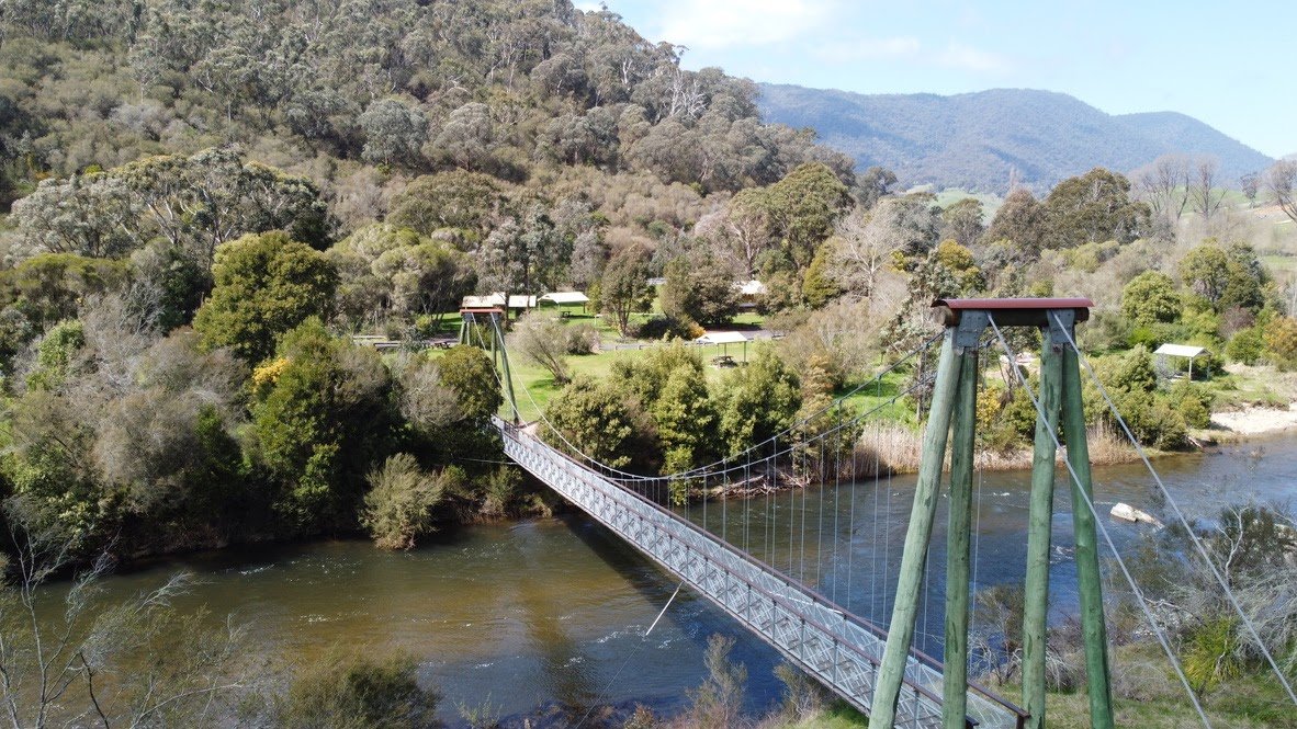
Above: Tumut Suspension Bridge
Where the track reaches the Micalong Station on Four Tree Rd, turn sharp right and then sharp left onto a 4WD track which runs alongside Micalong Creek. Forestry roads following the creek are used to reach Micalong Creek Campsite.
The track continues to follow Micalong Creek, both on forestry roads and foot track. For several kilometres the track is no more than 50m from the creek. A kilometre further on from here you will reach the Brindabella Road, which is one of the best all-weather access roads to the track. Approximately 3km south of Barrois Campsite a boardwalk crosses the Micalong Swamp, which is near the explorers’ original crossing place.
The track then follows a firetrail for 2.5km before a boardwalk across the Chinaman’s Creek arm of the swamp, which is also used by some wildlife to make a dry crossing. Just beyond the boardwalk there’s a clear, level area that’s suitable for camping.
The descent from the tableland to the Goobarragandra Valley, passing through The Hole, is on a foot track and is a favoured section for many track users. It is then approximately 6km over undulating terrain to the Thomas Boyd Trackhead.
The Thomas Boyd Trackhead is one of the most used facilities on the track. It’s popular with walkers, campers, fishermen, picnickers and car-bound tourists. The campground is managed by the Goobarragandra Valleys Trust and camping fees will apply. Book online here.
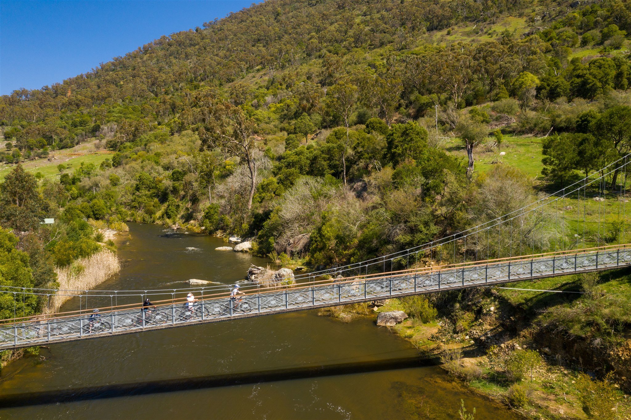
The first of two bridges, the Norm Harris Bridge, is within the trackhead grounds and crosses the Goobarragandra River. A foot track follows the river bank for about 4km to recross the river at the second bridge, the Jack Cribb Bridge.
After the second bridge the track continues for a short section in a reserve, then onto the Goobarragandra Rd, before dropping down to cross Buckleys Bridge over the river. From there a public road, passing through grazing properties, becomes the walking track for about 6km.
Just before reaching the heavily timbered country there’s a resting spot under some elm trees near the junction of Mill and Walls Creeks. The track crosses Walls Creek and then climbs steeply for about 600m before briefly entering Kosciuszko National Park. Signs and logos take walkers along a fence towards Foxes Gap saddle where you go over a stile at the fence and then head down a rough 4WD track.
The next 5km is through fairly open grazing land until it reaches the Snowy Mountains Highway. From the Snowy Mountains Highway the track is signposted via quiet roads south of Tumut until reaching Blowering Campsite on the northern end of the the Blowering Reservoir - the start point for the next section covered by Map 3.